Hiking

Medium

St. Wendelin - Kohlstattsee

Hiking

Hiking tour

+1

12,00 km

05:00 h

715 hm

720 hm

Information

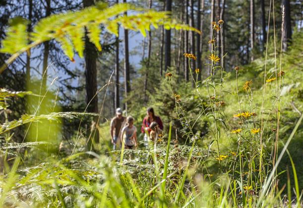
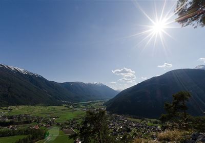
Your hiking adventure begins in the district of St. Wendelin, located just outside Nassereith. Here you will also find the small open-air stage “St. Wendelin Gotte,” which serves as a striking landmark. From the start, follow the forest road uphill. After a short time, you will pass a wildlife feeding station—an exciting place, especially in winter, but also a nice highlight along the way in summer. After a pleasant start, you will reach a well-signposted intersection. Here, turn right onto a smaller side path. This path is a little steeper at the beginning, but leads through varied terrain, including shady forest and open passages, where you will repeatedly be rewarded with magnificent views of the valley. The path continues to wind uphill – sometimes over root-covered forest paths, sometimes over soft meadow paths. Finally, you will reach the idyllically situated Kohlstattsee lake, nestled between gentle slopes and surrounded by forest.

A perfect place for a leisurely rest. From Sinnesbrunn, you enter the Starkenberger Panoramaweg trail. Contrary to its name, this section is not an open high-altitude trail, but rather leads through wooded and shady terrain along the ridge towards Nassereith. The trail is varied, but never exposed – ideal when it gets hot in summer. You will cross the Antelsberg area – a place name, not a mountain peak. But nature lovers take note: with a little patience, you may occasionally spot tiny scorpions here (in the protected areas!), which are found in the damp, shady zones – strictly protected and fascinating to observe! At the end of the Panoramaweg, you will reach the Mühlsprung section, which will take you back to the district of St. Wendelin. Now it's time to pay close attention again for the last few meters – then you've completed the loop!

Features & Characteristics

Stamina

Skill

Start Point

St. WEndelin

End Point

St. Wendelin

Circular hike

Yes

Map & Elevation Profile

Similar Tour Suggestions

DJI_0391.jpg

Medium

Hiking

Seenwanderung

Hiking

Hiking tour

+1

14,00 km

04:00 h

159 hm

160 hm

WF_Imst_T05_IMG_01_5939_Durner.jpg

Easy

Hiking

Salvesenschlucht (No. 16)

Hiking tour

Loop Hike

4,30 km

01:45 h

195 hm

988 m

2018-Wandern-Bergsteigen-Tarrenz-Sinnesbrunn-Alpleskopf-web-©Rudi Wyhlidal (85).jpg

Medium

Hiking

Alpeskopf (Tarrenton)

Hiking tour

8,00 km

757 hm

2258 m

2011-Jahreszeiten-Sommer-Natur-Muttekopf-Seabrig-©Peter Perktold (6).jpg

Easy

Hiking

Alpenrosensteig Nassereith

Hiking tour

2,00 km

00:45 h

56 hm

48 hm

2018-Wandern-Bergsteigen-Tarrenz-Sinnesbrunn-Alpleskopf-web-©Rudi Wyhlidal (83).jpg

Medium

Hiking

Galtenseitjoch

Hiking tour

6,00 km

03:30 h

500 hm

2421 m

Lochmühle.jpg

Medium

Hiking

Lochmühle

Hiking tour

3,70 km

01:30 h

198 hm

300 hm

1033 m

image.jpg

Easy

Hiking

Imsterberger Venetalm

Hiking tour

8,80 km

05:00 h

1099 hm

1980 m

Fernstein - Fernpaßhöhe.jpg

Easy

Hiking

Fernstein - Fernpaßhöhe

Hiking tour

3,60 km

01:50 h

303 hm

35 hm

1212 m

tirolimster-bergbahnenAlpine Coaster Logoarea47trustyou