Hiking

Medium

Anhalter Höhenweg

Hiking tour

16,00 km

09:30 h

1483 hm

Information

Course: Anhalter Hütte - Grubigköpf - Namloser Wetterspitz 

Connection: Egger Muttekopf, Bschalber Kreuzspitz, Elmer Kreuzspitz

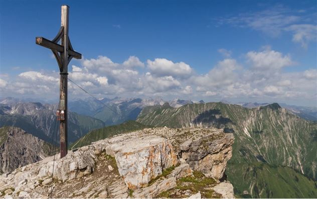
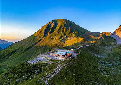
From the Hahntennjoch, you set off on a marked trail toward Steinjöchl (2,198 m). The trail climbs moderately and isn't too difficult, and soon you'll enjoy fantastic views of the surrounding mountains. After about 45 minutes, you'll reach Steinjöchl. There, you'll have your first direct view of the striking Namloser Wetterspitze – a perfect photo opportunity! From Steinjöchl, the trail descends toward Anhalter Hütte (2,042 m). The descent is pleasant, but you should be careful here, especially in wet conditions. The hut is a perfect place for a short break, a drink, or a snack. After the hut, the trail continues across beautiful alpine meadows and through gently rolling terrain toward Grubigjoch (2,230 m). Here, the challenge increases somewhat: the trail becomes steeper, and the terrain changes from meadow to scree. Now it becomes alpine and adventurous! From Grubigjoch, you follow the ridge to the summit. Absolute surefootedness and a head for heights are required here, as the path is narrow and somewhat exposed in places.

Recommended Equipment

Good hiking boots that fit perfectly and have good grip Warm hiking jacket that protects against wind and weather

Features & Characteristics

Stamina

Skill

Start Point

Hahntenjoch

End Point

Hahntenjoch

Map & Elevation Profile

Similar Tour Suggestions

Simmeringalm.jpg

Medium

Hiking

Simmeringalm

Hiking tour

9,50 km

04:30 h

1058 hm

1814 m

Rüsselbach.jpg

Medium

Hiking

Rüsselbach (No. 75)

Hiking tour

4,60 km

02:00 h

390 hm

1164 m

Eagle Walk Stage: 20

Hard

Hiking

Eagle Walk Stage 20: Hanauer Hütte - Württemberger Haus

Eagle walk

11,00 km

07:00 h

1240 hm

930 hm

2480 m

Screenshot 2024-04-26 104202.jpg

Medium

Hiking

Kohlstattsee

Hiking tour

6,50 km

314 hm

362 hm

1500 m

Fernsteinsee-1.jpg

Easy

Hiking

Rundwanderweg Fernsteinsee

Hiking tour

12,10 km

04:00 h

157 hm

152 hm

imst_wenzler_050.jpg

Easy

Hiking

Milser Au (No. 79)

Hiking tour

1,40 km

01:30 h

5 hm

727 m

2018-Wandern-Bergsteigen-Tarrenz-Sinnesbrunn-Alpleskopf-web-©Rudi Wyhlidal (83).jpg

Medium

Hiking

Galtenseitjoch

Hiking tour

6,00 km

03:30 h

500 hm

2421 m

alm08.JPG

Medium

Hiking

Tarrenton Alm

Hiking tour

22,00 km

07:30 h

779 hm

777 hm

1577 m

tirolimster-bergbahnenAlpine Coaster Logoarea47trustyou